 |
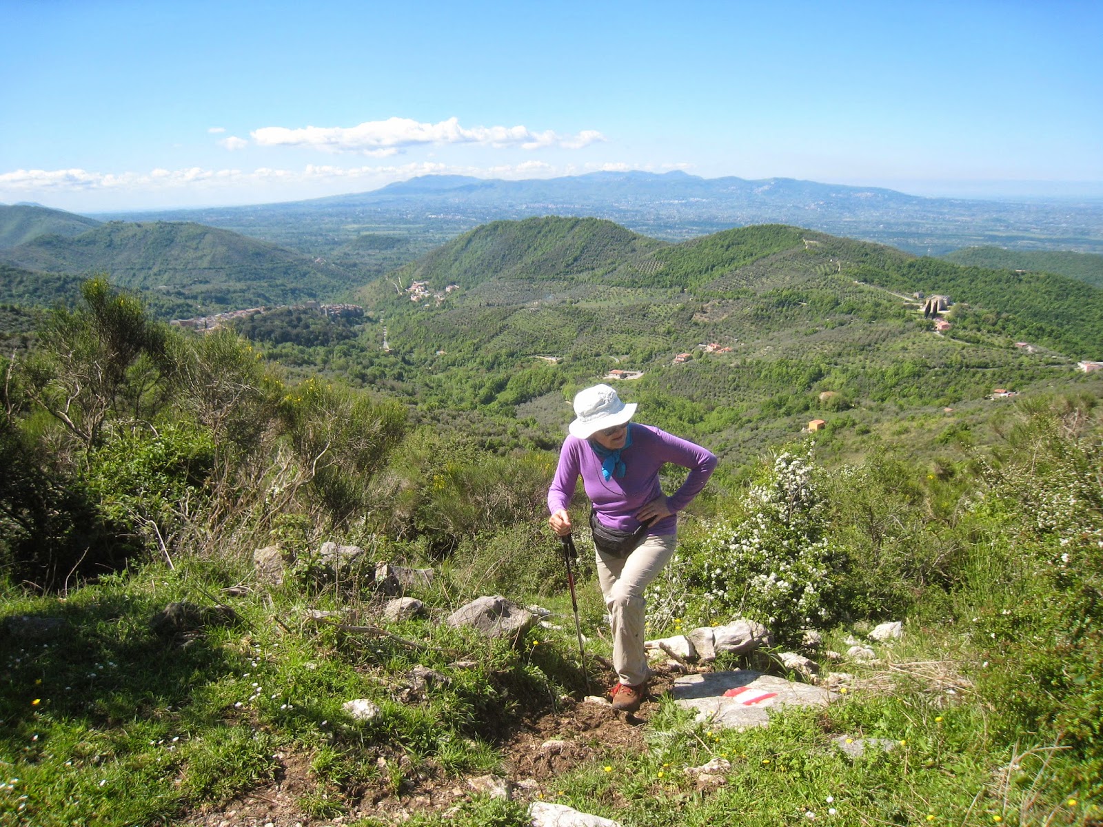
Dianne hard at work. The convent is at right center. In the distance, the Colli Albani (right half, yielding to
Rome's basin) and the Monti Lepini (the slight rise, left of center). Part of the town is visible center left.
We're about 1/3 of the way up at this point. Note the hillside above Dianne is being intensively cultivated. |
Our second hike of the season. Somehow, Dianne found a place we hadn't been: a ridge in the Monti Prenestini, with a trail head near the small town of San Gregorio da Sassola. The town is pretty much straight east of Rome, out via Prenestina (i.e., in ancient times, led to the now-called town of Palestrina), then on some other roads best negotiated with an iPad or iPhone, about half of it on curvy country roads tailor-made for our Malaguti (and entertaining too, we think, even in a car).
We pulled into the main square at half past 9--1:20 from Rome--had a 2nd coffee at the only bar (a male hangout, as it happened) in the piazza, while admiring the astonishing castle that towered
 |
| Hi-tech entrance to the medieval section |
above and marked the entrance to the medieval city, though with an electronic info board. We had with us little information--the starting point, near the convent on the hill above the town; and a CAI map (see below the post) marking the trail with a red line.
Concerned about a possibly torturous road up to the convent, we decided to walk--down the road a few hundred yards, then up the hill near the convent (about 100 meters vertical, about 1/2 mile). Here, and from this point on, the trail is marked in red and white--very frequently and, with rare exceptions, clearly. See the map below. The first mark is on the pole opposite the restaurant, and it refers to the asphalt path on the left (not the one on the right). We had feared--and the asphalt at first confirmed our fears--that the "trail" might turn out to be nothing but a road or, at best a mulattiera--a dirt road once used for hauling stuff with, yes, mules.
 |
| Up the fenceline |
But not far ahead, at the gate, the trail turns into the woods--and it remains in the countryside, except for a few brief asphalt stretches. For a while it follows a fence line, then moves up the side of the ridge, traverses a small, rocky hillside before emerging into a more open landscape, above. There are a few (and unavoidable) very narrow and very muddy sections where even straddling the mud was only partially successful--so wear good boots and carry at least one pole.
 |
| High country |
Splendid views of the town, the monastery, Rome's basin (note Calatrava's sail-like, never-used swimming pool in Tor Vergata) and, as we climbed higher--eventually about 680 meters or 2000 feet above San Gregorio da Sassola--panoramic views of some 7 mountain ranges, including the snow-covered Gran Sasso. Our goal was to reach the nob-like Spina Santa, where our CAI trail 516 meets 500, and we almost made it, choosing to defer the conquest and do it the Italian way: have lunch and forget the peak--otherwise known as hike-to-eat. So we had our sausage, cheese and bread within a few hundred yards of Spina Santa.
 |
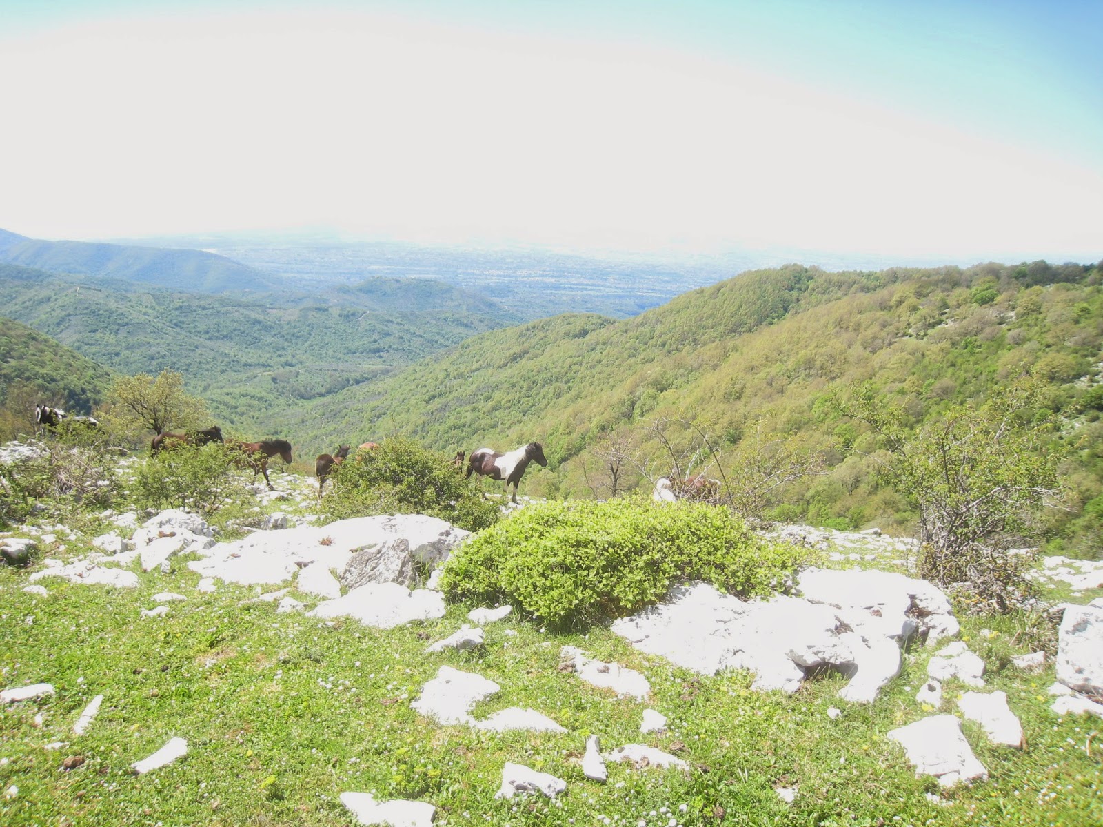
| Those guys followed us |
It's horse country up there, and we saw four or five bunches of 5-7, each with one or two foals. Unaccustomed to contact with humans they don't know--and we did not see another person on the trail or tending to the herds--these high country (at 3000 feet and above) horses are usually skittish, and that was our experience on this hike, too. So it freaked us out a bit when several horses started following us across an open grass bowl, as if we had apples and sugar lumps. There are cows, too, on most Italian hikes, though we saw only two: one on a road we were crossing, and another--just a carcass--near the apex of our journey.
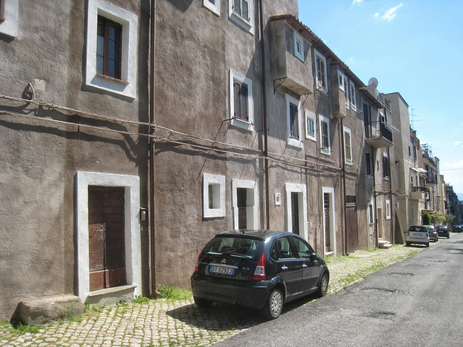 |
| Well maintained older buildings |
The descent was swift and gorgeous, with spectacular views to the east and, to the north, of handsome Monte Gennaro and the Monti Lucretili, every peak familiar. Reaching the restaurant on our return, we decided to take another road down to the town: the one just above the restaurant. It curls clockwise and takes you through the newer section of the town--past the town park, an esedra-shaped apartment complex, past some very old but nicely maintained residences, and into the piazza--about 4:30 from the start.
As is our habit, we shared a large bottle of beer at a table outside the bar (embedded in rock, Disney-like but real), admired the castle and the range behind it once again, and toasted to our fine day in the mountains. Good pick, Dianne! Then on the scooter, and home.
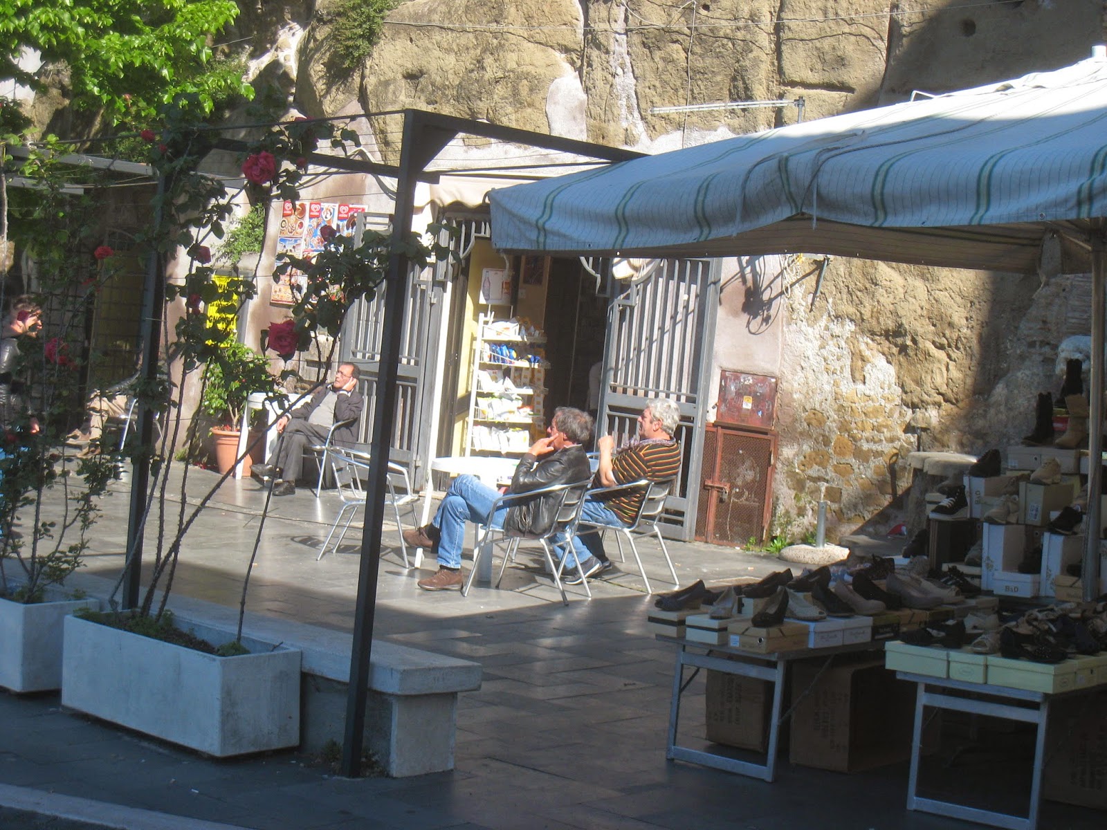 |
| Town bar, carved from the rock, |
Bill
 |
| Horses scamper away |
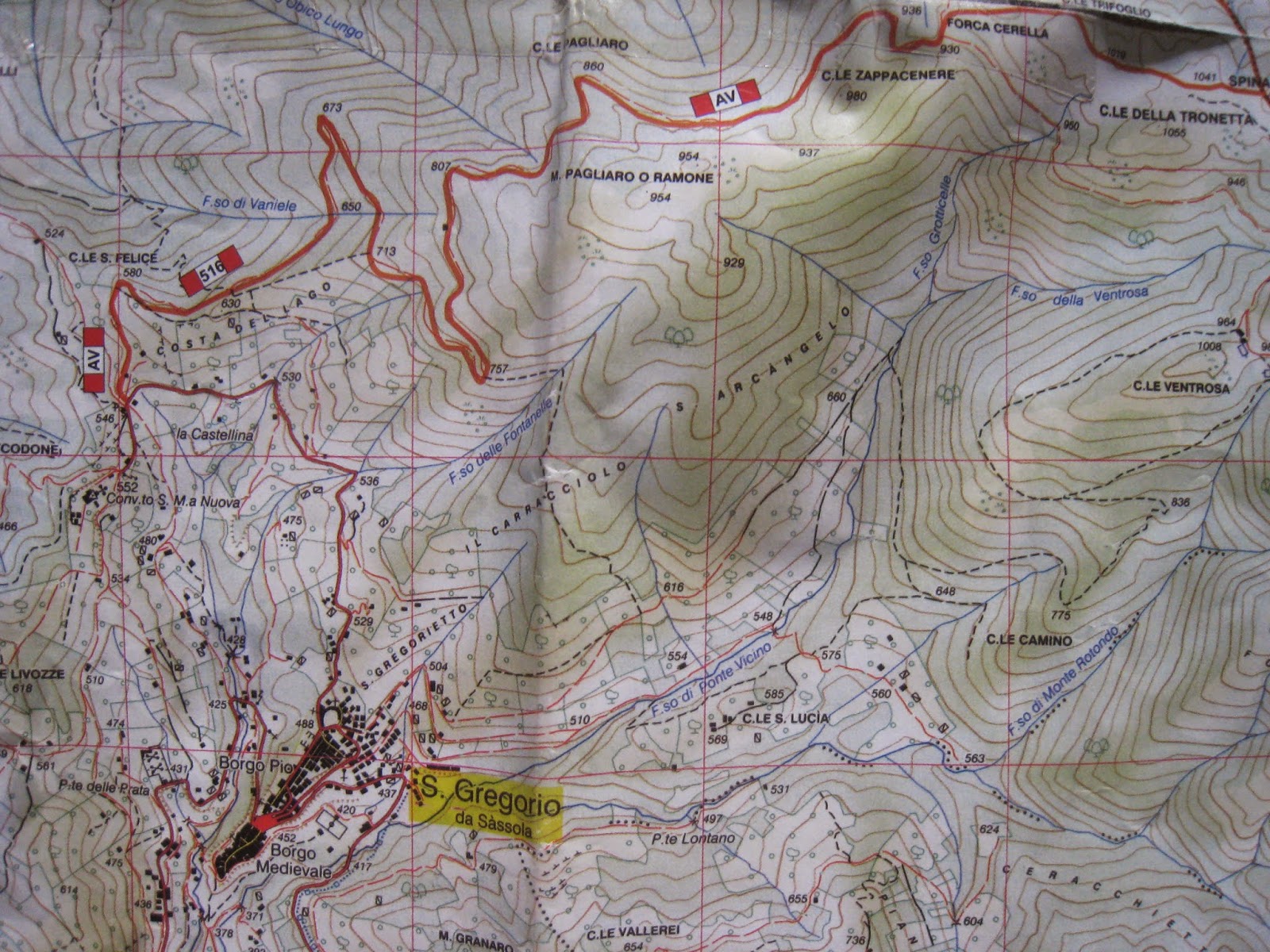 |
The darker red line at top tracks the trail, ending (for us) at far right. We started at the (red) center of San Gregorio da
Sassola and took the road (not clearly marked here), up to the convent. We returned by the thin red
line that comes into the town at its northern end. "AV" means the "alta via" - or crest road (literally "high way")
of the Prenestini. |


No comments:
Post a Comment